The definitive route will be presented when the peak of the rivers’ drought reaches, when the route will be redone and verified the passages through the crossings of rivers and streams or diversions.
The design of the routes was strategically developed to offer safety, performance for speed and use of all variables of the Amazonian nature such as trails, beaches, ponds, socavões, ravines, clays, sand, Igarapés, rivers, roots, trunks, foliage, pastures, ascents and descents and passages through indigenous communities, riverside, farms, and branches!
The control points will have an average distance of 10k and will offer hydration, Isotonics, fruits, treats and Amazonian spices, in addition to the emergency, rescue and health service!
Come and live an experience different from your daily life, with so many sounds, mysteries, and curiosities inside the immensity of the flora and rivers of our Amazon rainforest!
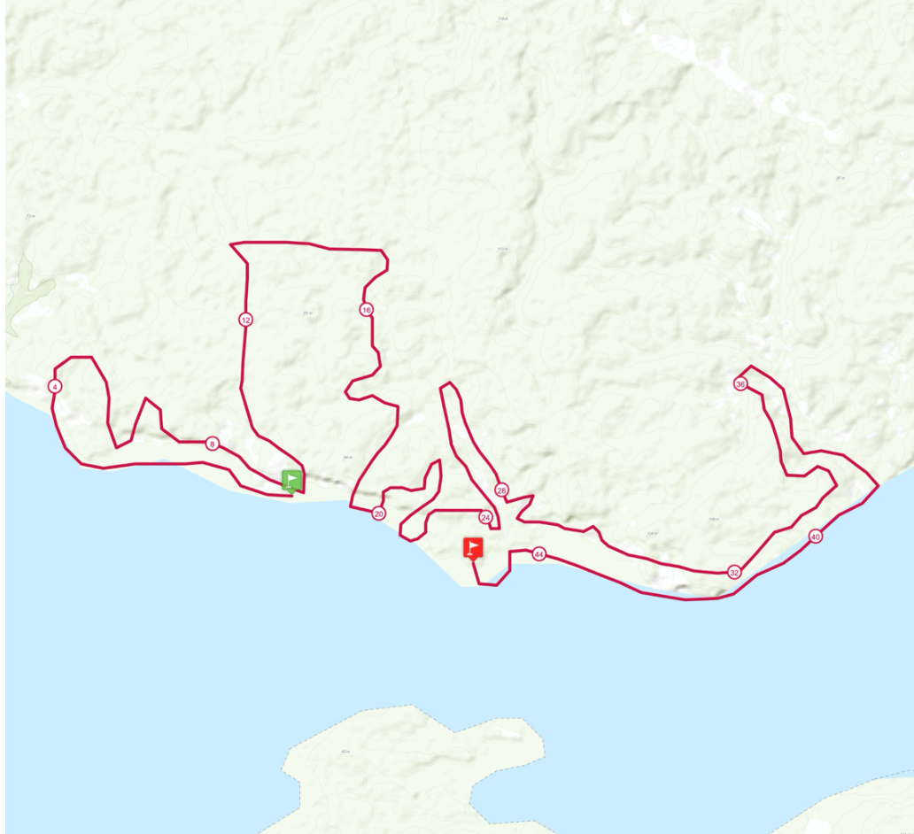
10/29/2021
START AT THE BEACH OF ALDEIA TATUYO
Original route with 45 km and may vary according to the ebb of the Rio Negro to up to 30km
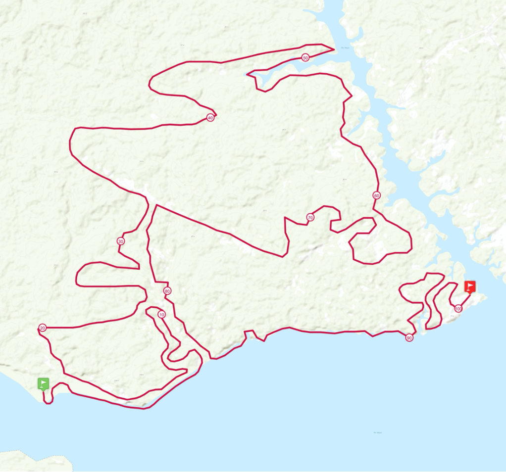
10/30/2021
LEAVE AT ALDEIA CIPIÁ BEACH
Original route of approximately 100 km, which may vary according to the ebb of the Rio Negro for 90 km
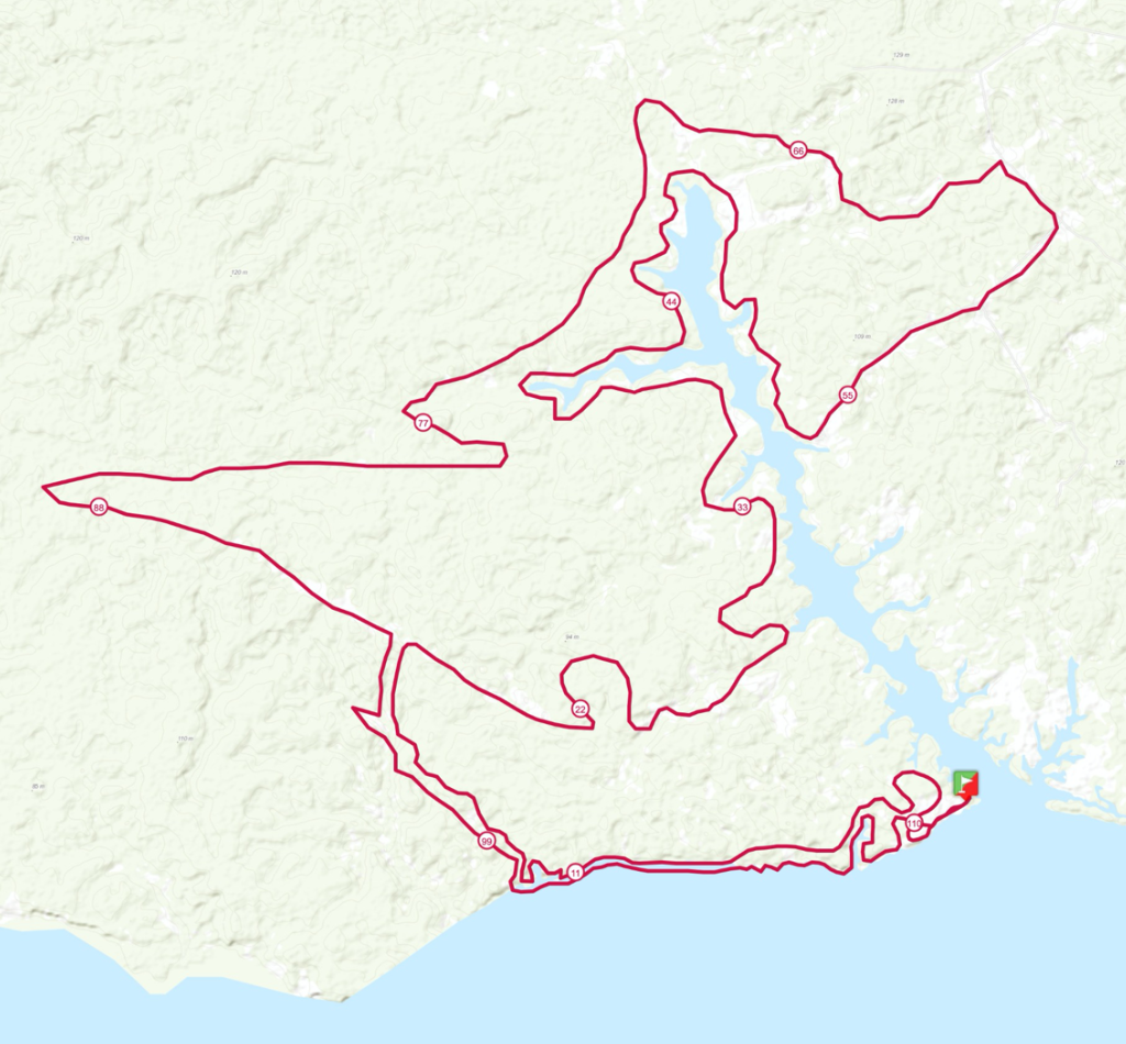
10/31/2021
STARTED ON THE BEACH OF THE LIVRAMENTO COMMUNITY
Original route with approximately 110 km, which may vary according to the ebb of the Rio Negro for 100 km
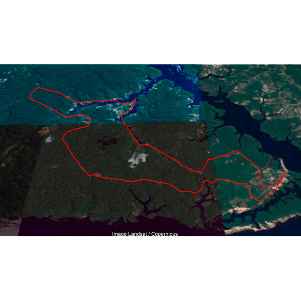
10/31/2021
STARTED ON THE BEACH OF THE LIVRAMENTO COMMUNITY
Alternative routes with 21km, 16km and 08km

